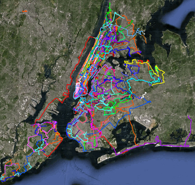
I am, at heart, a map geek. I’ve loved detailed maps since I was a kid, and my map collection, somewhere in a storage bin in Miami, amounts to the thousands. So it shouldn’t be strange for me to actually map every walk I’ve taken in New York City. Following is the Google Earth image of all my walks:

You can see the map above in Google Maps.
If you notice a small orange strip on the top left hand side, that’s a walk in Paterson, New Jersey. I was going to walk from there to Newark through the Lenape Trail. But I was really under the weather that day and limited the whole day to the Great Falls of the Passaic.
When you see this map, keep in mind that this obviously doesn’t take into account non-walks. Which is to say, I’ve been to Sheep Meadow, the Village and many, many other locations countless times.
But I wasn’t in a long walk, so that’s not on the map. I was looking at Gantry Plaza State Park, one of my favorite locations in NYC, and of course, I was wondering why I’ve only been there once. Of course, I haven’t. But it’s only been part of a bona fide walk a couple of times.


Recent Comments